

Day Trip: Carmel, Meridian Hills, Westfield and Noblesville
This day trip by car runs from Meridian Hills through Carmel and Westfield to Noblesville and ends at Potter's Covered Bridge for the Golden Hour. Along the way it takes in the Monon Trail, built on the former Monon Railroad line, the Palladium in Carmel, a historic school building in Westfield and downtown Noblesville.
6 stops · about 19.0 mi between the stops in a straight line
The route
- Meridian Hills – 3.7 mi to the next stop
- Monon Trail – 2.0 mi to the next stop
- The Palladium at the Center for the Performing Arts – 5.0 mi to the next stop
- Westfield – 6.3 mi to the next stop
- Downtown Noblesville – 1.9 mi to the next stop
- Potter's Covered Bridge
Planning the light
All times are for Noblesville, in local time. In late June (June 21), the Golden Hour begins at 8:36 p.m. and the sun sets at 9:16 p.m. at 302°, west-northwest; the Blue Hour lasts until 9:49 p.m. At the spring equinox (March 20), the Golden Hour begins at 7:20 p.m., with sunset at 7:56 p.m. at 271°, almost due west. At the winter solstice (December 21), the Golden Hour starts at 4:39 p.m. and the sun sets at 5:22 p.m. at 240°, west-southwest.
1 Meridian Hills
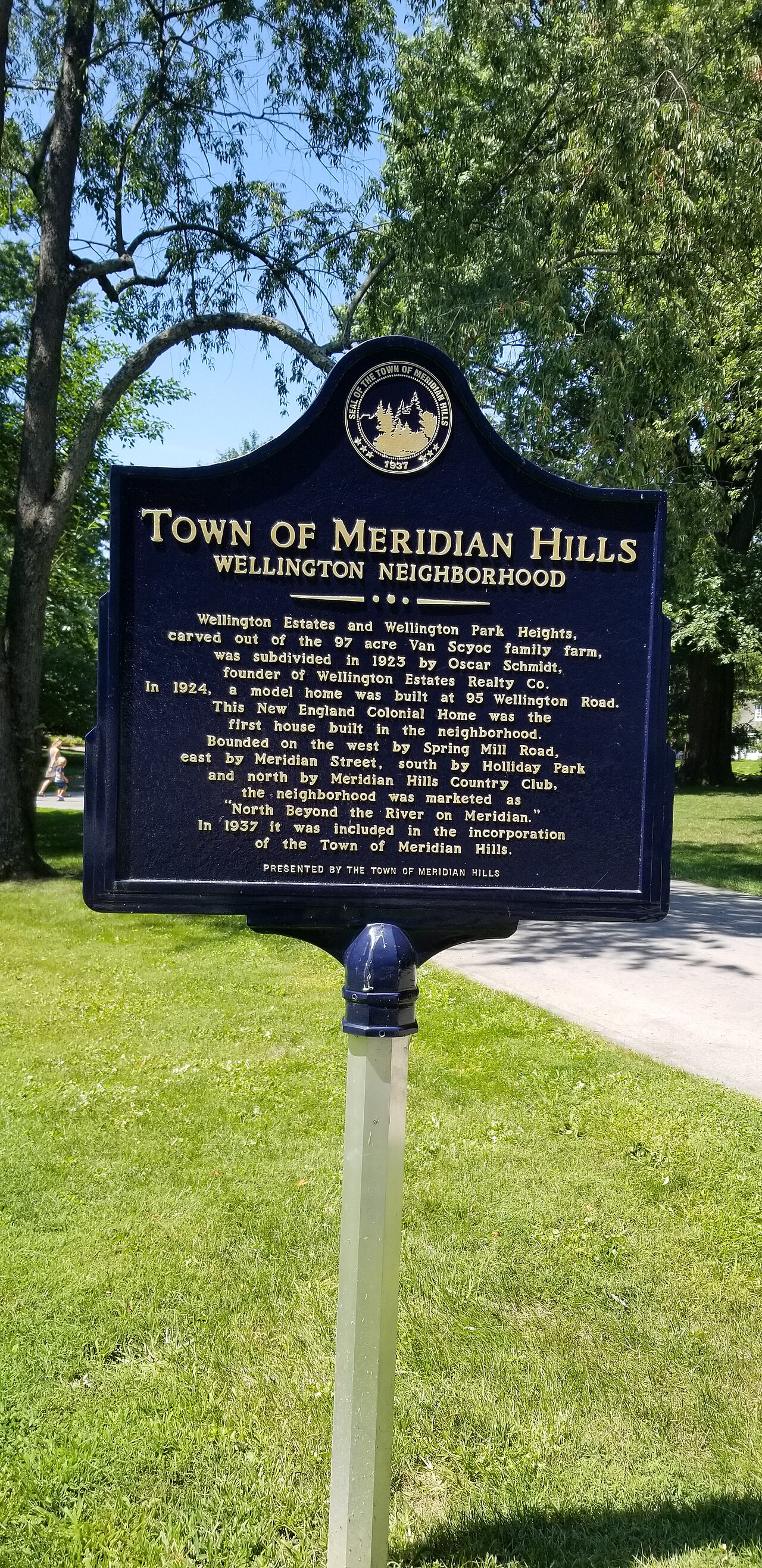
Meridian Hills is a town in Washington Township, Marion County, about 8.0 miles north of downtown Indianapolis. Residential construction began in the early 1920s and Meridian Hills Country Club opened in 1923, but the town did not incorporate until 1937. Since 1970 it has existed as an "included town" within Indianapolis as part of Unigov. The photo shows the historical marker that describes the history of Meridian Hills. Frame it tightly enough that the text stays legible, and photograph it in soft morning light before driving on to Carmel.
2 Monon Trail
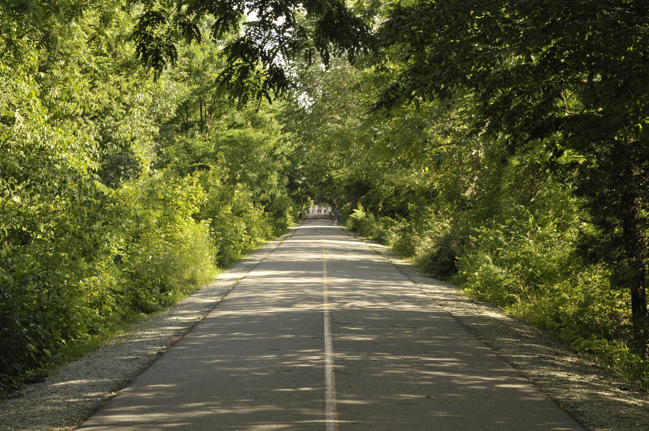
The Monon Trail is a rail trail along the main line of the Monon Railroad, which connected Chicago, Indianapolis and Louisville. After the company was sold in 1987, the section between Indianapolis and Delphi was abandoned; the trail dates from 1996, has an asphalt surface and, as the Monon Greenway in Carmel, is part of the Rails-to-Trails movement. Within 3.7 miles along the trail the map shows a stream, five bridges, four ponds, two fountains and two memorials, among them the Policeman memorial and Carmel Creek. The photo shows part of the Carmel section. Use the paved path as a leading line, and look to the bridges and ponds for foreground.
3 The Palladium at the Center for the Performing Arts
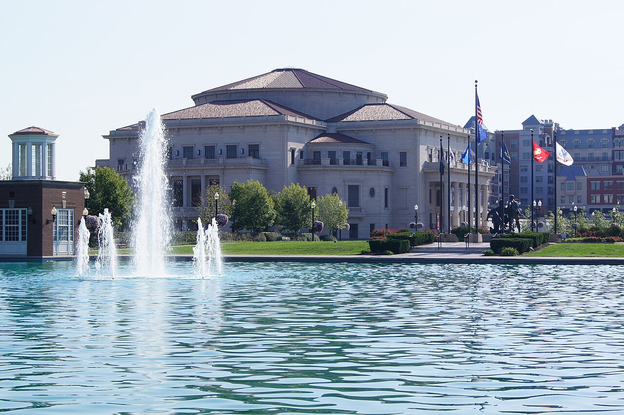
The Payne & Mencias Palladium is a 151,000-square-foot concert hall and one of three venues of the Allied Solutions Center for the Performing Arts; it opened on January 29, 2011. David M. Schwarz Architects designed it in the New Classical style. Its four-fronted, symmetrical design, massed around the domed central space of the single-room hall, was inspired by Andrea Palladio's Villa Capra, La Rotonda. That symmetry suits a centered, straight-on composition with the verticals kept parallel. The photo shows the Palladium at the Center for the Performing Arts in Carmel.
4 Westfield
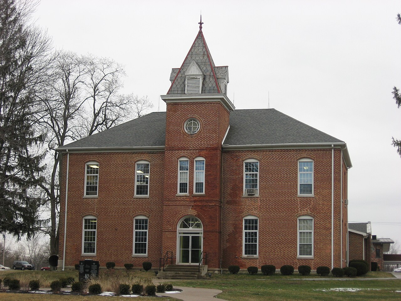
Westfield was founded on May 6, 1834, by the North Carolina Quakers Asa Bales, Ambrose Osborne and Simon Moon, and the town is believed to have been planned as a stop on the Underground Railroad. The photo shows the front of the main building of the former Union High Academy at 434 S. Union Street. Built in 1861, the brick building is part of the Union High Academy Historic District, which is listed on the National Register of Historic Places, and is classed as Greek Revival architecture. Frame the whole front and keep the camera level so its lines stay straight.
5 Downtown Noblesville
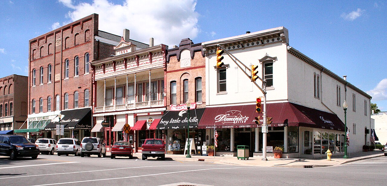
Noblesville is the county seat of Hamilton County and lies along the White River. Its history dates to 1818, when the government purchased the land that is now Hamilton County from the Native Americans of the area; William Conner and his wife Mekinges Conner, a Lenape woman, had established the first trading post in central Indiana in 1802. The photo shows downtown Noblesville and is filed among Hamilton County's historic districts on the National Register of Historic Places. Downtown hosts the Indiana Peony Festival and the Front Porch Music Festival, which together draw more than 40,000 visitors, so check the festival dates before you plan street scenes.
6 Potter's Covered Bridge
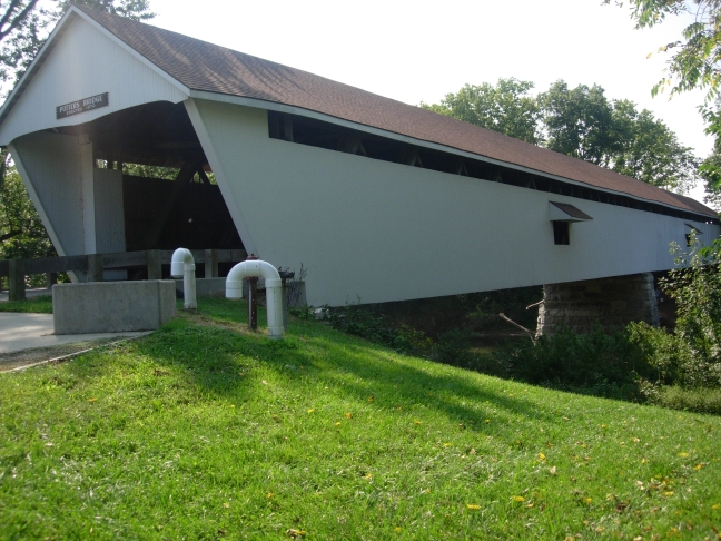
Potter's Covered Bridge, also known as Potter's Bridge and Potter's Ford Bridge, stands in Potter's Bridge Park in Noblesville and is the Golden Hour finale of this tour. Built in 1871, it is a single-span Howe truss structure 260 feet long, 22 feet wide and 20 feet tall that rests on limestone abutments, with walls clad in vertical board siding. It is listed on the National Register of Historic Places. To fit the full 260-foot span, use a wide lens or step back; low evening light brings out the texture of the board siding and the limestone. The photo shows Potter's Bridge, a historic covered bridge in Noblesville.
More photo spots in and around Carmel are in the Carmel photo guide.
More photo tours nearby
- North Indianapolis Photo Tour: Museums, the Canal and Broad Ripple
5 stops – Photo tour north of downtown Indianapolis: Benjamin Harrison's home, the Children's Museum, the State Fairgrounds, Broad Ripple and Newfields. - West Indianapolis Photo Tour: Zoo, Speedway and Eagle Creek Park
4 stops – Photo tour west of downtown Indianapolis: the Indianapolis Zoo, historic Speedway, the Motor Speedway and its museum, and sunset at Eagle Creek Park. - Downtown Indianapolis Photo Walk: From Mass Ave to White River State Park
9 stops – A photo walk through downtown Indianapolis: Mass Ave, the War Memorial, Monument Circle, the Canal Walk and sunset at White River State Park.