

Louisville Photo Tour: Churchill Downs, Cave Hill and Floyds Fork
This driving tour leaves downtown Louisville for four places in the south and east of the city: the racetrack of the Kentucky Derby, the zoo, the Victorian Cave Hill Cemetery and the creek parks along Floyds Fork on the eastern edge of Jefferson County.
4 stops · about 19.5 mi between the stops in a straight line
The route
- Churchill Downs and Kentucky Derby Museum – 3.5 mi to the next stop
- Louisville Zoo – 2.8 mi to the next stop
- Cave Hill Cemetery – 13.2 mi to the next stop
- The Parklands of Floyds Fork
Planning the light
Plan to end the day at Floyds Fork on the eastern edge of the county. In late June golden hour begins at 8:29 p.m. and the sun sets at 9:09 p.m. in the west-northwest (301°); at the spring equinox it sets at 7:54 p.m. due west (271°); at the winter solstice golden hour begins at 4:44 p.m. and the sun sets at 5:25 p.m. in the west-southwest (240°).
1 Churchill Downs and Kentucky Derby Museum
Churchill Downs has hosted the Kentucky Derby, the first leg of the Triple Crown, since it opened in 1875; with the infield open on Derby day it holds about 170,000 people. The track was named in 1883 after the Churchill family, who had leased the land, and the owners who bought it in 1894 commissioned its twin-spire grandstand. On the grounds, the Kentucky Derby Museum opened in 1985 with two floors of exhibits and a 360-degree theater; five past Derby winners are reburied on its grounds, and the 2006 winner Barbaro is buried outside an entrance to the track, where visitors need no ticket. The photo was taken on Derby day.
2 Louisville Zoo
The Louisville Zoo, the "State Zoo of Kentucky", opened on May 1, 1969, in the Poplar Level neighborhood and covers 134 acres with more than 1,200 animals in eight large exhibits, from The Islands and Africa to Glacier Run with its polar bears. Its four-acre Gorilla Forest won the 2003 exhibit award of the Association of Zoos and Aquariums, and a restored Philadelphia Toboggan Company carousel has been part of the zoo since 1997. The photo shows the front gate.
3 Cave Hill Cemetery
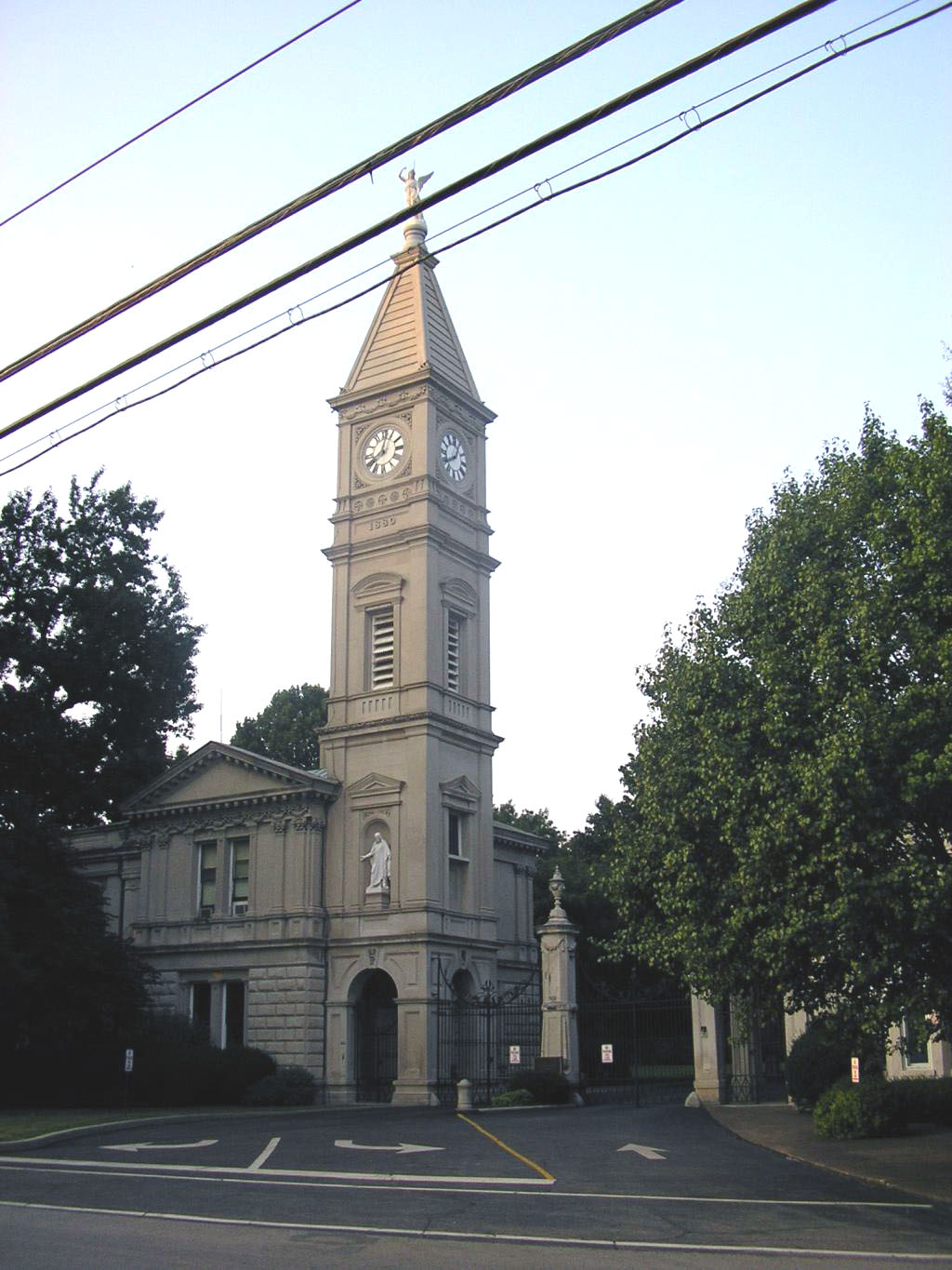
Cave Hill Cemetery, dedicated in 1848, is a Victorian cemetery and arboretum of 296 acres, the largest cemetery in Louisville. Civil engineer Edmund Francis Lee laid it out to follow the undulating hills, promontories and basins of the former Cave Hill Farm. The main entrance on Baxter Avenue, with the entrance lodge and gates designed by William H. Reddin in 1880 in Italian Renaissance Revival style, is shown in the photo. The cemetery has been listed on the National Register of Historic Places since 1979; respect its opening hours and the graves.
4 The Parklands of Floyds Fork
Floyds Fork, named after the early surveyor John Floyd, is a 62-mile tributary of the Salt River and the largest watershed in Jefferson County. Along it, Louisville created a park system of nearly 4,000 acres, named after the waterways that link its four main parks. Pope Lick Park, 575 acres, includes the former Floyds Fork Park off Taylorsville Road; to the north, Beckley Creek Park, 616 acres, has the 22-acre "Egg Lawn", named for its shape and circled by a walking path. The photo shows the creek in Pope Lick Park.
Downtown Louisville, Museum Row and the Big Four Bridge are covered by the Louisville Museum Row photo tour; more spots are on the Louisville photo guide.
More photo tours nearby
- Louisville Photo Tour: Water Tower, Museum Row and the Big Four Bridge
6 stops – Photo tour of Louisville: the Water Tower, Museum Row with the giant bat, the Ali Center, NuLu and sunset on the Big Four Bridge over the Ohio. - Cincinnati Photo Walk: Art Museum, Eden Park and Mount Adams
4 stops – Photo walk in Cincinnati: the Cincinnati Art Museum, Krohn Conservatory, the lakes and overlooks of Eden Park and Immaculata Church on Mount Adams. - Downtown Indianapolis Photo Walk: From Mass Ave to White River State Park
9 stops – A photo walk through downtown Indianapolis: Mass Ave, the War Memorial, Monument Circle, the Canal Walk and sunset at White River State Park.